

Imagine looking at one state in forty-year intervals . . .
Documenting Kentucky: Three Photographic Surveys
our recent exhibit at the Frazier History Museum in Louisville KY, which ran from April into November, did just that.
Between 1935 and 1943, Roosevelt’s New Deal Resettlement Administration (RA) and Farm Security Administrations (FSA) sent photographers all over the United States creating what came to be the visual record of the Great Depression. Photographing in Kentucky were: Russell Lee, Ben Shahn, Carl Mydans, Esther Bubley, John Vachon and most notably Marion Post Wolcott.
In the era before television and the internet, news came to Americans through newspapers, magazines and movie newsreels. RA and FSA released their images to these sources. As Director Roy Stryker said, “We were introducing America to Americans.”
With the American Bicentennial imminent, Ted Wathen founded the Kentucky Documentary Photographic Project (KDPP) in 1975 with the goal of photographing in each of the state’s 120 counties. Informed by the National Endowment for the Arts that the Project could possibly receive funding if he added at least two more photographers, Wathen enlisted Bill Burke and Bob Hower. Their work was exhibited at the Speed Art Museum, the International Museum of Photography at the George Eastman House and the Smithsonian American Art Museum.
The Frazier History Museum revived KDPP’s work in 2011 as Rough Road: The Kentucky Documentary Photographic Project 1975-77. The response to that exhibit was so strong that Wathen and Hower reincorporated KDPP and hired a diverse group of 26 photographers to document the state anew beginning in 2015.
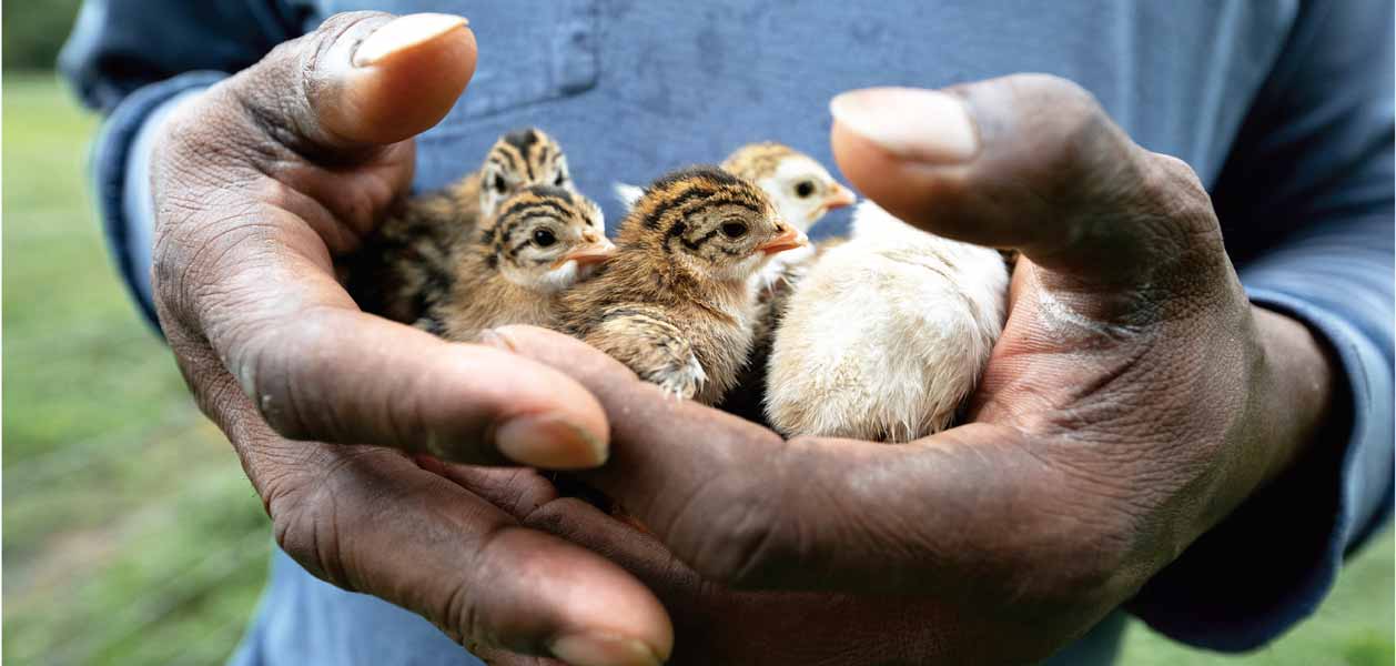
Documenting Kentucky: Three Photographic Surveys is a visual tone poem to the state of Kentucky interweaving photographs from the three documentary projects. We explore:
- How we looked
- How we worked
- How we used the land
- How we worshipped
- How we lived
Read about the exhibit here on Louisville Public Media.
So what’s next?
The book and the movie, that’s what. We’ve done a rough layout for a book with about 200 images and passed it on to our writers – to Erik Reece for the introduction, and to Arwen Donahue for sourcing text from Kentucky writers to accompany the pictures. We are working with Kertis Creative here in Louisville to produce a movie about the three Surveys and how we put them together. Here’s a teaser trailer from Kertis: